What I Built for KolterIn-house mapping data
Retained to source large-acreage land for master-planned and active-adult communities across Florida. The deals come from the data, so the data is what I built first.
There was no one place to see every tract.
Kolter Homes builds single-family and Cresswind active-adult communities. I was retained in October 2024 to find the land those communities sit on — family ranches, citrus and farm operators, trusts and institutional holders with tracts from 100 to 10,000 acres — and the engagement was renewed past its original one-year term.
The finding, in the first weeks: the land team had no single place where every tract, every owner, every contact and every deal stage could be seen at once. Owner information lived in county records, deal status lived in people's heads, and the pipeline lived in whichever deck had been sent most recently. So the first deliverable was not a deal. It was the database, and the deals have followed from it.
and researched
across the database
Brevard to Collier
Florida and Texas
division map deck
mapped
covered
the hot sheet
The landowner database
County by county, from Brevard and St. Lucie on the east coast to Pasco, Sarasota and Collier on the west: every tract of a size Kolter could build on, who owns it, how to reach them, what has been said, and where it stands.
- 180-plus tracts, roughly 145,000 acres, 14 counties. Each record carries the owner, the acreage, the parcel data and the full contact history. Updated and shared with the land team monthly.
- A hot sheet of 20-plus active targets, reprioritized as owners respond, go quiet, or sell to somebody else.
- Written follow-up after every meeting with the acquisition lead — county by county, with the next step on every tract, so nothing depends on anyone's memory of the conversation.
- Direct, off-market outreach to the owners themselves. Letters, calls and visits to ranches, groves and family trusts that have never listed and would not answer a broker's blast email.
The maps
A land team thinks in maps, not spreadsheets. So the database got drawn.
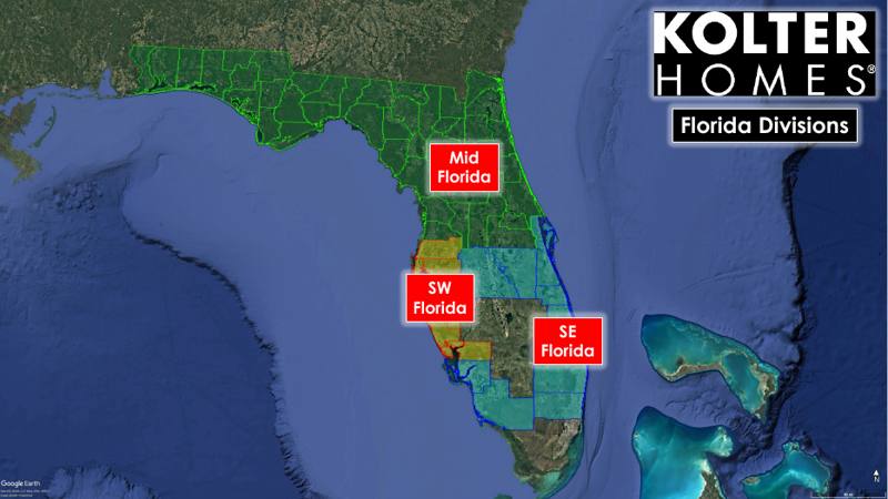
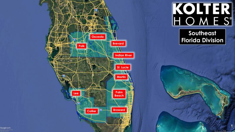
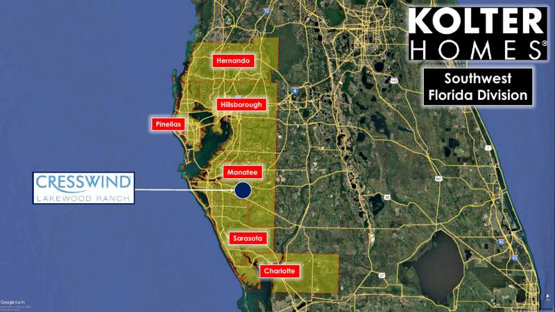
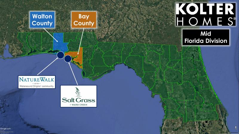
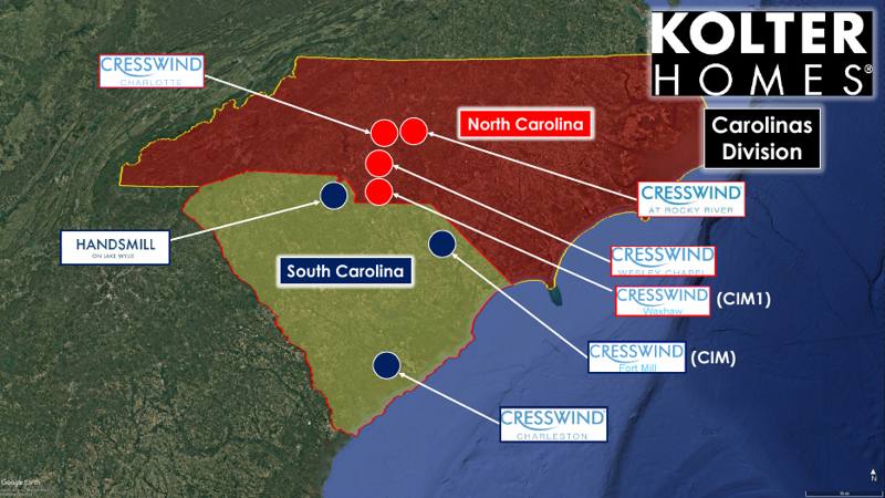
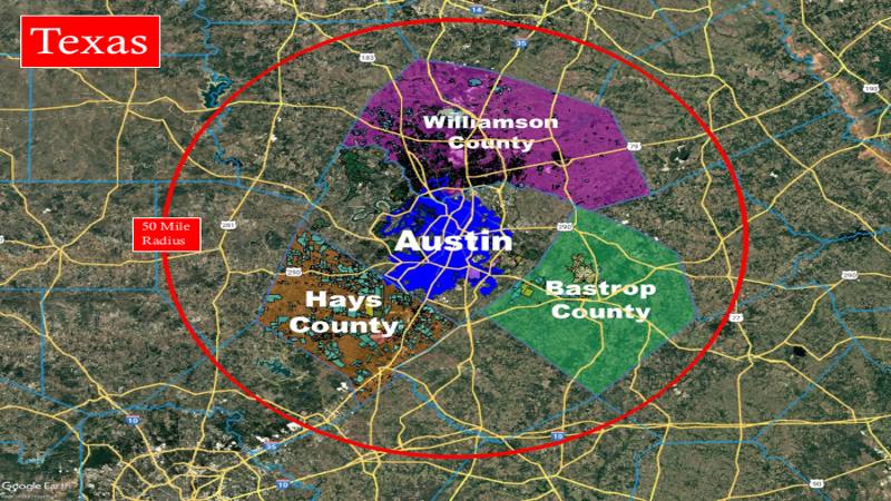
Six of the 49 slides. Every slide is a Google Earth map drawn by hand: county sets per division, active communities, and the tracts in pursuit, colored by status.
- Google Earth intelligence maps for 17 counties in Florida and Texas: parcel overlays, owner labels, retail and competitor locations, so a tract can be judged in context before anyone drives to it.
- The division map deck — 49 slides covering six divisions in eleven states. Every active community, every tract under contract or in pursuit, every new market under study, colored by status: operating, under contract, pursuing, dead. It became the document the land team and the acquisitions lead worked from.
- Competitive decks for the Florida divisions — Southwest, Southeast and North Florida — mapping competing active-adult and master-planned communities against Kolter's existing Cresswind locations.
Market research
Where should the next division go? The same method that found tracts in Florida was pointed at the states Kolter was considering.
- Texas — Austin, Dallas–Fort Worth and Houston MSA reports.
- The Carolinas, and a multi-state divisions presentation covering Florida (Southeast, Southwest and Mid-Florida), the Carolinas, the Mid-Southeast and Texas.
- New-market studies for Alabama, Georgia, Indiana, Ohio, Tennessee, Virginia, West Virginia and Maryland, and Northwest Florida.
Nine versions of the same deck in five weeks.
The map deck was right the day it was sent and out of date the next morning. It lived in Google Earth files and PowerPoint, so every change meant a new file, and the land team ran a second system for parcels and owners that knew nothing about the pipeline deck — and the deck knew nothing about it.
That is not a Kolter problem. It is what happens to any hand-maintained map, and it is the lesson that led directly to VMAP: the next version of this work is one live map on a private link, where a deal changes once and every division sees it, and where the county data underneath — parcels, owners, zoning, flood, soils, schools, traffic — is the same data the land team was opening a separate subscription to get. That map exists now; you can read what it does on the VMAP page.
About the work I would do for you
- I start with the system of record, not the pitch. The first thing a client gets is the place where everything lives. Everything after is faster because of it.
- Research is a product, not a favor. Eight-state expansion studies and seventeen counties of mapping were delivered on a schedule, in a format the team already used.
- I know when a deck has become a liability. Nine versions in five weeks is the signal to stop maintaining and start building. I would tell you that about your own spreadsheets.