What I Built for VMAPvmapdata.ai
A live county map I own, run and bill for — and the same four steps, in the same order, that I sell to clients.
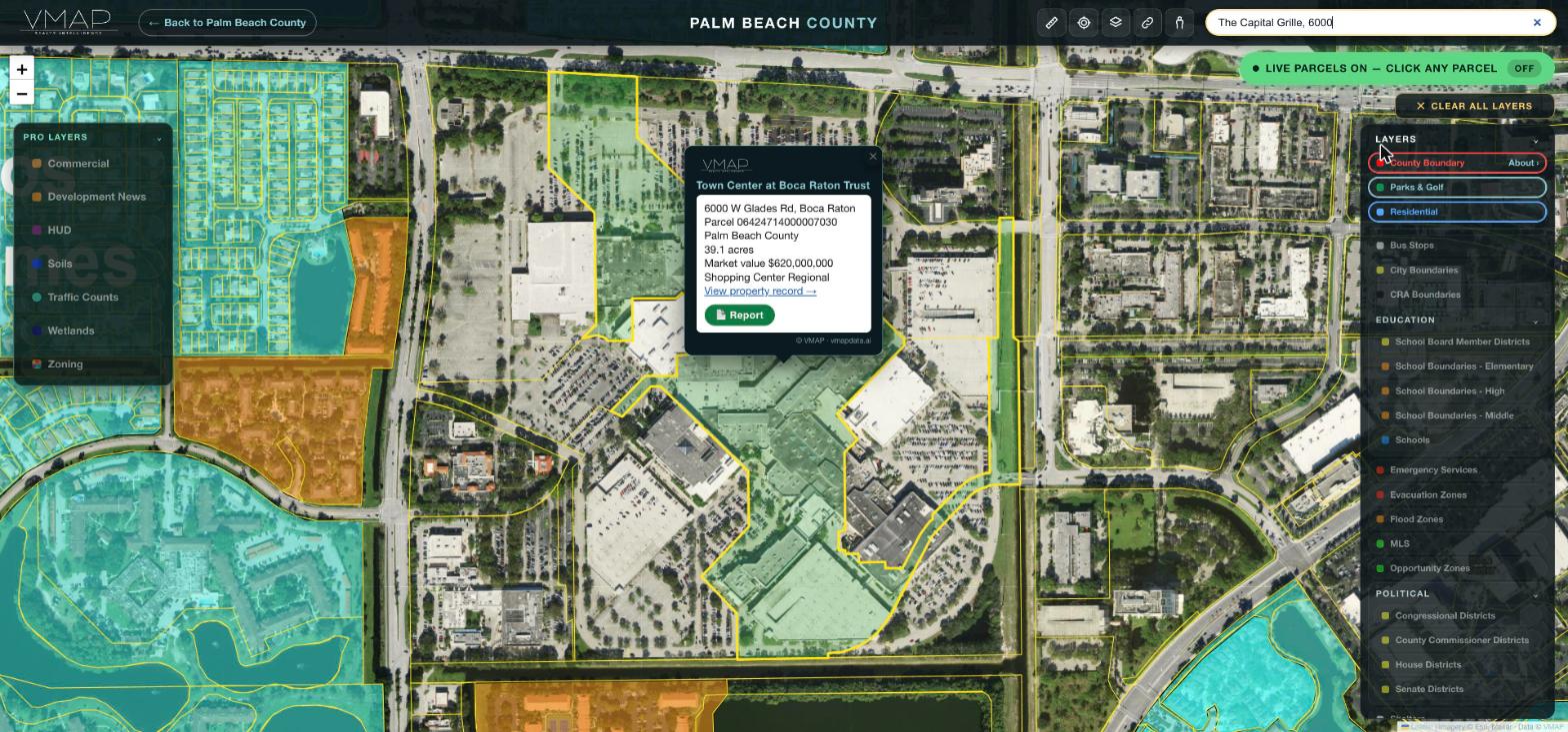
Five websites, one property, every time.
Check one property and you open the property appraiser for the owner and the value, the county GIS for the zoning, FEMA for the flood zone, the school district for the assignment, and a roster to find who represents it. VMAP puts all of it on one live map — click the parcel, get the whole story.
It is live at vmapdata.ai, it is mine, and you can open it on my laptop while we are sitting there. This is the thing I built with nobody telling me what to do — which is the better test of whether I know how.
built
covered
Florida county included
every county
Layer, county and state totals are read from the live site's own data file. Coverage is still going county by county, and a layer marked not yet mapped is one I have not built there yet — that is a roadmap, not a claim.
What one click produces.
Every parcel on VMAP opens a report like this one — owner, value, zoning, flood, wetlands, soils, schools, fire, the officials who represent it, development news within three miles and distances to everything that matters — with three buttons at the top: text it, email it, or print it as a clean PDF for a listing appointment.
This is a real report for a home in Woodfield Country Club, Boca Raton, produced October 29, 2026, as the Print / Save PDF button delivered it, with the owner's name blurred. Open the PDF →
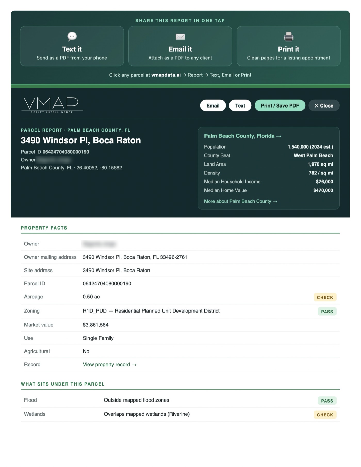
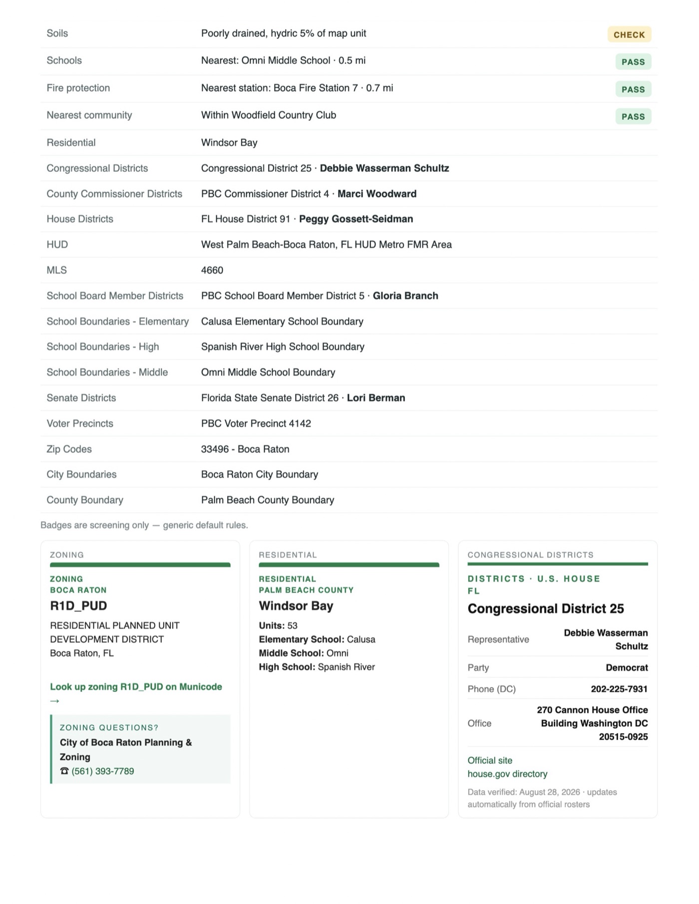

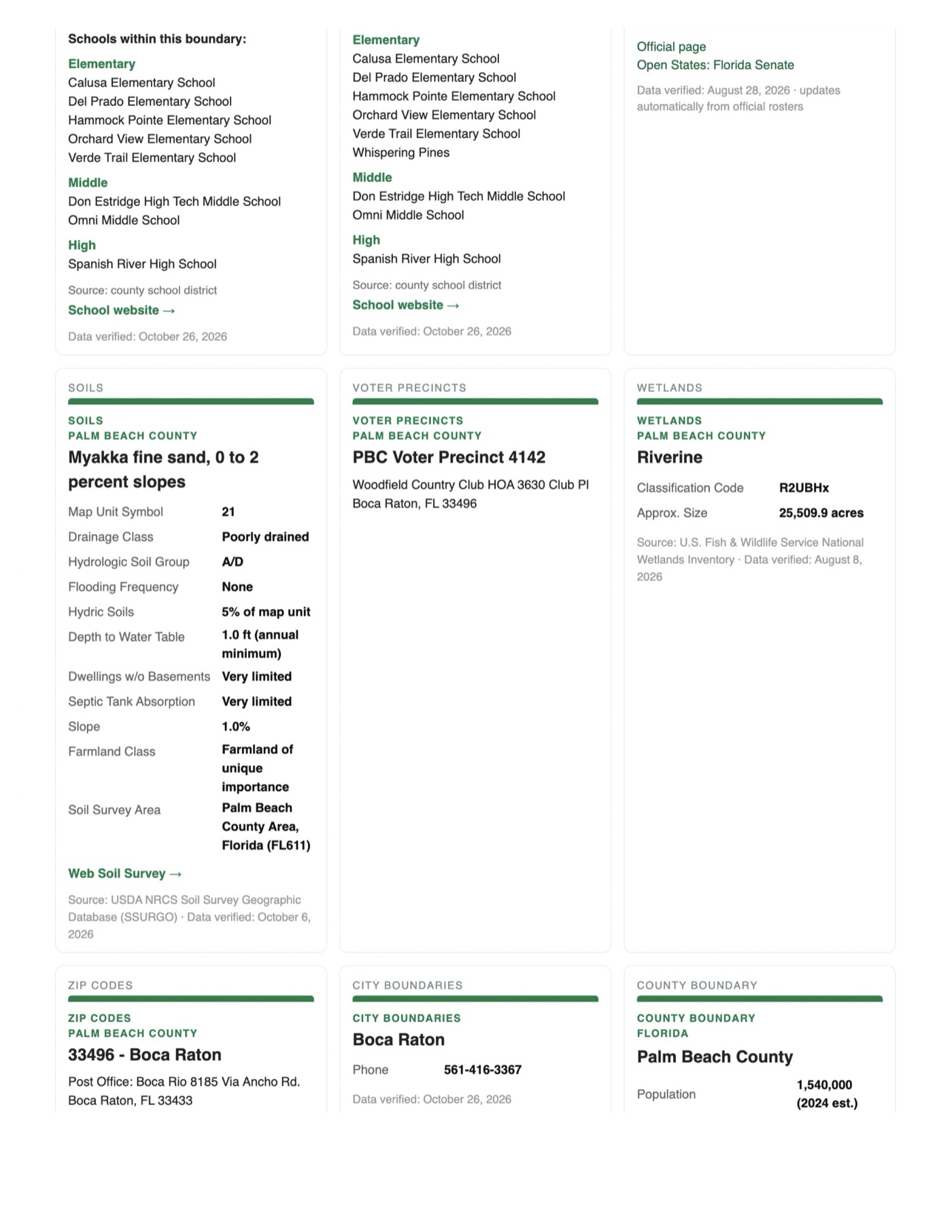
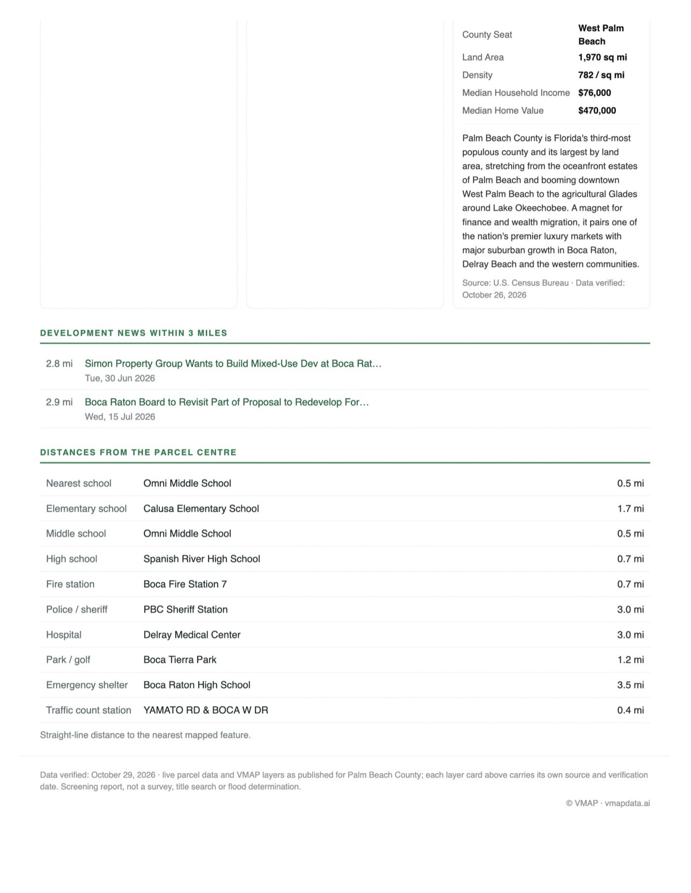
Page 1 of 5. Pages 2 to 5 open the full PDF.
Owner and parcel details are public property-appraiser records as published by Palm Beach County. Screening report, not a survey, title search or flood determination.
Same steps as a client engagement, same order.
The method is not something I invented on the drive over. This is what each step looked like when the client was me.
Step 1 — Find the work worth doing
Every number a broker needs on a property is already public and already free. It is also spread across five different websites that do not know about each other, each with its own format and its own search box. Nobody was going to consolidate it, because the data is not the hard part. That was the finding, and everything below came out of it.
Step 2 — Build one thing, put it in production
One live county map in the browser. Zoom to street level and parcel lines stream in as you pan. Click anything and a card stacks: owner, acreage and value from the property appraiser, the zoning district, the flood zone, the school assignment, and the commissioner and legislators who represent it, with phone numbers.
Step 3 — Make the workflows run together
The same map for every county covered — 10,304 layers across 966 counties in ten states. Five base layers stay free with no signup. The rest is a $49-a-month subscription billed through Stripe, and it holds.
Step 4 — Take myself out of it
Every Monday a scan sweeps 270 counties for new construction, screens each find against written rules, and writes what survives into the map. A second pipeline renders the marketing clips and posts them to four platforms on a fixed schedule. Nothing goes out until I approve it, and nothing needs me on the day it does.
None of what follows throws an error. That is exactly the problem.
- The page that quietly lied. My catalog page advertised one layer count while the homepage read another — same source file, but one reads it live and the other had the number baked in months earlier. No error, no broken link. It had simply been telling Google the wrong thing for weeks.
- The paywall that quietly opens. A county page cloned from a stale template ships with the paid layers unlocked for everybody. The page loads. Nothing errors. You are giving the product away until somebody notices. There is now an automated check for exactly this.
- The video that posts nothing. Instagram publishes from the public web address, never the local file. Seven videos sat queued and were missing from the site — the first would have failed the next morning with no warning. A check now compares the two by checksum before anything is scheduled.
- The address that misses. Type an address and the geocoded pin lands on the street centerline, not the property, so the obvious parcel lookup returns nothing. The fix is a forty-meter search, five candidates, take the most valuable to skip the road slivers.
- The eight places. Publishing a county means registering it in eight separate files. Miss one and the page exists but nothing points at it. Every one has shipped broken at some point — which is why a county now passes a forty-check audit before it goes out.
Three products, three proofs.
Five base layers on a live map for every county covered — parcels, county and city boundaries, school boundaries, residential. No account, no download, works in any browser.
Proves: pulling structured data out of public systems never built to talk to each other — the same machinery that reads a lease or a title commitment.
Zoning, flood and evacuation zones, traffic counts, commercial, wetlands, HUD, soils and the development pipeline. $49 a month, every county, billed through Stripe.
Proves: a clean data layer with a real product on top of it, and a paywall that holds — the shape of an Operations Build.
A Monday scan sweeps 270 counties for new construction and writes what qualifies into the map. A second one renders the marketing clips, writes each platform's copy and posts to four of them on a fixed schedule.
Proves: sourcing and follow-up that run on a calendar instead of on somebody remembering.
About the work I would do for you
- I build the checks before the features. Forty of them here. That is not perfectionism — it is the only reason a system built by one person can be trusted by somebody else.
- It runs on nobody's permission. The free layers need no account and no download. Same principle in your business: built in your accounts, on your keys, so it keeps running whether or not I do.
- Where a thing is not automated, I say so. One of the five platforms I post to is still done by hand, because the automated route needs a review I have not finished. I would rather tell you than let you assume.
- Private data stays out. My own commercial comps are deliberately excluded from the public product. Deciding what must never ship is part of the build, not an afterthought.